Pages

Thursday, August 29, 2013

Rinjani : The Departure

Short story of the departure: 

1st leg of the trip: Jogja-Banyuwangi
Collaborators for this trip:
Alejandro Gunawan
Dionysius Bloko Wardhianto
Pius Badu Agung
Fransiskus Nugroho
At 7 August 2013 we went to Giwangan bus station to catch bus to Banyuwangi. We departed from Giwangan at 11.30am, on our way we planned to change bus to Bali in Jember about 2 hours from Banyuwangi, because it supposed to be easier. The bus we took was Mila Sejahtera, a shitty economy class bus it cost us only Rp 85.000 per person cause we changed our destination to Jogja-Jember, Jogja-Banyuwangi would cost us Rp 100.000, if your height is more than 170cm, sitting in this kinda bus is a torture, your knees will stuck against your front seat. We suggest you take the last row seat of the bus, there you have more room for your legs from the aisle to the backdoor. But it was a fun Ied's eve bus ride, both the driver and the conductor were crazy, they bought firecracker and lit it along the way. We reached Jember bus terminal at 2 am in the 8 August 2013. Then we waited for the 4 am bus to Bali, we got the bus but they refused to depart due to the passengers were only four of us. So we took another bus to Banyuwangi it cost us Rp 20.000 per person. 2 hours later around 6 am we reached Banyuwangi, it was the morning of Ied during the prayer, no city bus were operating, we needed city bus to reach Ketapang harbor. Finally we found one city bus that was operating but it cost us Rp. 15.000 rupiah per person, normally it would just cost us Rp 5.000.
Then we headed for Ketapang ferry harbor to cross to Gilimanuk Bali, after we bought Rp. 8.000 passenger ticket we head for Bali at 9am. Time to chilled out on the ferry.

2nd leg of the trip: Bali
Collaborators for this trip:
Alejandro Gunawan
Dionysius Bloko Wardhianto
Pius Badu Agung
Fransiskus Nugroho
Galang Wijaya
8 August 2013 around 10am we landed in Gilimanuk harbor Bali, we took another economy class bus to Denpasar, it cost us Rp 40.000 per person. We arrived at Ubung bus terminal Denpasar around 2pm. Chilled down and tried to contact our friends in Bali, around sunset we headed to Sanur to our friend house Janset Berzeg and Ika to take dinner and shower. We inserted our coin by 9pm and voila.... here came new player: Galang Wijaya. He arrived from Jakarta by airplane. And this was our final group: 4 sehat 5 sempurna. We rented a car for Rp. 320.000 that took us from terminal to our friend house then to the airport then to the Padangbai harbor in east Bali. At midnight we were at Padangbai, it cost us Rp. 40.000 for ferry ticket pervperson then we boarded for four hours crossing to Lembar harbor Lombok. The ferry departed at 1am, it was full we have to sleep in the out deck, the wind was chilling cold but the constellations were drop dead gorgeous, we had a good night rest.

3rd leg of the trip: Lombok
Collaborators for this trip:
Alejandro Gunawan
Dionysius Bloko Wardhianto
Pius Badu Agung
Fransiskus Nugroho
Galang Wijaya
5am 9 August 2013 our ferry docked in Lembar harbor. Badu negotiated a rental car that will take us to Sembalun, one of the nearest town to Rinjani. Price was agreed at Rp 600.000 per car. 6 am we departed our driver was Bli Chemonk, it was an episode of initial D, drifting in curvaceous mountain road. By 9am we arrived at the national park ranger office to register our name for the hike.

That's our 3 legs of journey that lead us to the ultimate soul journey at Rinjani. Enjoy the pictures.

Giwangan bus terminal last fasting day
7 of August 2013, waited for bus to Banyuwangi
© alejandro gunawan 2013

Inside Mila Sejahtera Jogjakarta-Banyuwangi Economy Class Bus
© alejandro gunawan 2013

Healthy Feet © alejandro gunawan 2013

Tirtonadi Solo bus terminal 7 August 2013 © alejandro gunawan 2013
also at Tirtonadi Solo bus terminal © dionysius wardhianto 2013
soto lombok, bus rest Gempol East Java
© dionysius wardhianto 2013
stranded, the 1st day of Ied in Banyuwangi bus terminal
8 August 2013 © dionysius wardhianto 2013
Banyuwangi bus terminal © fransiskus nugroho 2013
the only operated minibus in Banyuwangi
© dionysius wardhianto 2013
minibus Banyuwangi-Ketapang Harbor © alejandro gunawan 2013
Ketapang Harbor Banyuwangi 8 August 2013
© alejandro gunawan 2013
Ferry crossing Ketapang Banyuwangi-Gilimanuk Bali
8 August 2013 © dionysius wardhianto 2013
Ketapang harbor, all aboard!!!
© fransiskus nugroho 2013
Badu on the ferry © alejandro gunawan 2013

Artwork of Alejandro © alejandro gunawan 2013

Badu and Bloko © alejandro gunawan 2013

Bloko wrote an entry in his diary
© alejandro gunawan 2013

Badu and I © alejandro gunawan 2013
Alejandro and Bloko on Ketapang ferry
© fransiskus nugroho 2013
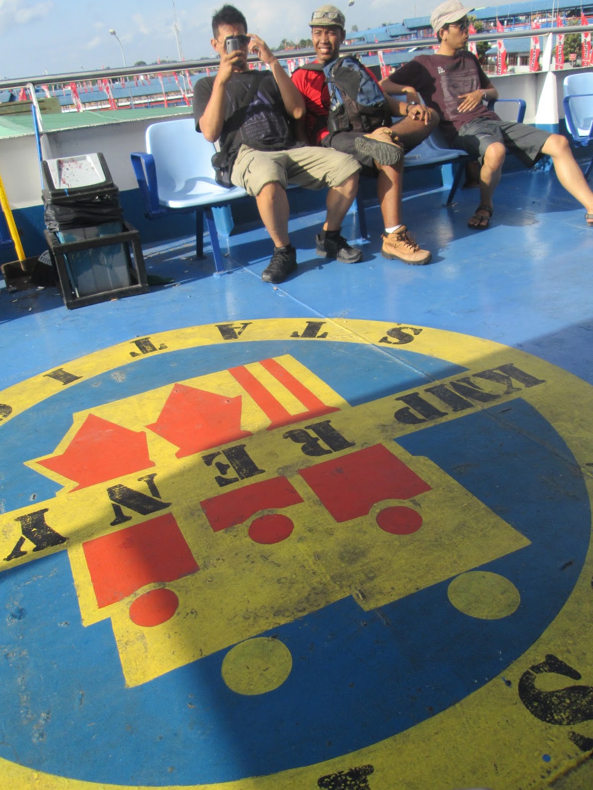
Cargo deck © alejandro gunawan 2013

Inside another economy class bus
Gilimanuk Harbor-Denpasar Bali 8 August 2013
© alejandro gunawan 2013
Badu and Bloko, Gilimanuk-Denpasar bus
© fransiskus nugroho 2013
Ubung bus terminal, Denpasar Bali
8 August 2013 © dionysius wardhianto 2013

G N' R bus © alejandro gunawan 2013

Ubung bus terminal, Bali © alejandro gunawan 2013
Packing eggs in front of minimart, Ubung Denpasar
© fransiskus nugroho 2013
Padangbai Harbor, Bali 8 August 2013 © alejandro gunawan 2013
Early morning ferry crossing
Padangbai Bali-Lembar Lombok, 9 August 2013
© fransiskus nugroho 2013
Padangbai-Lembar crossing © fransiskus nugroho 2013
Ridge overlooking Sembalun town, Lombok 9 August 2013
© alejandro gunawan 2013

galang, bli chemonk, badu, bloko, me © alejandro gunawan 2013
Bli chemonk, Sembalun drift, © dionysius wardhianto 2013

at the basecamp Sembalun Lombok
9 August 2013 © alejandro gunawan 2013

rinjani scale model © alejandro gunawan 2013

rinjani eruptions from time to time
© alejandro gunawan 2013


View departure rinjani in a larger map

Tuesday, July 30, 2013

gendol

gendol river
We were back on the ride, that sunday back on the bumblee bee wandering the river of gendol and kuning. The trip was started in afternoon, just 3 of us, me, my brother, and my cousin. After refueled we headed to the big stone at the sabo dam of gendol river, just above the dam, we descended into the river, gendol river is one of the floodway for merapi volcano, literally there are tons and tons of materials in form of volcanic sands, gravels, stones, and gigantic stones. The sabo dam was created with Japanese vulcanologist assistance. Its function is to stop those material floods from entering the city. 

overlooking gendol river


We met fellow enduro motorists there, most of them are my brother's friends. Tag along with them, to make long train of enduro bikers. The motorist cruised along sand miner truck track but sometimes the track just end and we have to make our own route, climbing up and down the valley banks and crossing creek. Even entering village road along the river. All for sudden when I took pass of miner truck my rear tyre blew up, replaced it in the nearest garage we can find, then continue our journey. 


my bro


We decide to cross gendol river then down to cross kuning river and go to museum gunung merapi in the west side of kaliurang road, there is playground for off road motor enthusiasts, with circuit and obstacles simulating off road condition. I got no gut playing in that playground, just sat smoked and drank shitty cheap rice wine that was brought by one of the motorist.
One small happiness of that day. Put a little smile on my face. Let's do this shit again bro.

along sand miner's track 

enduro motorist in museum gunung merapi circuit

Thursday, July 25, 2013

merapi

sunrise from pasar bubrah
So volcano, we meet again and this time was not a motorcycle trip again. It's a hike, damn, yes it was true six hours walk man. So it was nine of us, divided into two team, the fast new school express and the slow old school express.
Basically over and under 30 group. The only fast express over 30 was our mountain guide Badu, that saturday it was his 3rd hike in that week.


the summit
We left city of Jogja by 7pm that evening and reached the town of Selo by 9pm. We registered our name and group in the last village that was nearest to the volcano, which also act as first base camp for the hiker. The basecamp was good, that place is also used as radio tranceiver and one of the monitoring bases to observe Merapi volcano activity, the status was active normal, safe for hikers to reach the summit crater.


pasar bubrah
Our hike was started at 10.00pm, Badu our mountain guide lead the way on ward to the first mountain post. Bloody hell the first route that was still in form of an asphalted road is very steep, it's heavy. After leaving the asphalted road we entered steps of farm fields, farmers grow tobacco and cabbage in this area.
The steps were acceptable (for an old dude like us) in this area, upon leaving the farm area the path getting extremely steep again. The new school express gain the upper hand of leaving us, while the old school express stayed relax, chatted, and joke a lot along the way. While the new school walk in meditation silence. Surprisingly for us it was aunt widi (the youngest in the old school express) always lagged behind even behind the oldest uncle alejandro, come on dude you are no longer babe, you are dude for us.


aunt widi and her niece riris
We stopped at several places not just at those four resting posts, overall it was 6 hours hike. We left our beloved aunt widi in the small cave at kendit the rocky area not far from pasar bubrah the last post before summit. Because her tiny ass was slowing us all down, she got vertigo and her feet blistered from the stupidly moron cat walk with uncle alejandro to jatiningsih couple days earlier.


3 stooges
Then we reached pasar bubrah, an open field with volcanic stones as far as we see. Pasar bubrah literally mean mashed up market, it was believed as the market of the spirits in the mountain by the locals. We rest a while there before summiting for sunrise. It supposed to be an hour final hike to summit, at 4.30 we hike again but it was the hardest hike. We were already exhausted by the long hike, and in this final route the path consist of sands and loose gravels, the climb was very very steep we need to use hands, our feet kept sinking to soft sands, really drain our energy, I was the last in our train party. And there were herds of bules tourists stampeding toward the summit.
We finally started to leave the hell of sands steps and reached rocky part. But one of the new school express hit the wall, could not continue anymore, uncle alejandro and me had to rush her down to pasar bubrah for safety reason


badu the mountain guide

Then we chilled down under the setting moon and the rising sun. It was all hell broke freeze. We were just too lazy and tired to re-hike for the summit.
Enjoying the majestic sun rose and gave us all warmness. We waited for the new school express to descent then we made hot chocolate and instant noodle in pasar bubrah. Rest even nap in the stony path.


We came down at 9am and reach the Selo by 12noon. Headed back to Jogja for grilled pork, it was heavenly wicked end. I will do just do it and do it again. And in the next day morning of July 22nd, Merapi got small eruption, it was raining volcanic ashes.
moron family, video by pius badu


sleep on the path

old school + new school = big happy family

uncle alejandro

on the ridge

majestic


View merapi in a larger map

Saturday, July 20, 2013

onward to the ocean

Really sorry, no motorcycling on this occasion, that sunday morning me, panji, and dharma metup with our international friends from AITI program from MIT, Nicole, Lynn, and Markus.
We got no plan that day and we just rolled away, we decided to go to the beach without any proper beach clothing, I meant jean and T-shirt only.
We head for the south karst hill-range of Gunung Kidul, meandering through the curvaceous hill road. With beautiful scenery, sorry guys no photograph, I was driving.

After two hours about 34km away from the city we reach the beaches. The beaches face Indian Ocean. Ngobaran and Nguyahan are two adjacent beaches. Ngobaran is a cliff rocky beach, it got Hindu temple on it. That place is believed as the final resting place of the last Hindu ruler in Java, King Brawijaya XVII from Majapahit empire in 14th century.
And then we started to make pictures as how tourist should behave. Lynn particularly is a photographer enthusiast, I think she made a lot of nice photographs, come on Lynn share your pictures with us.

Then we went to Nguyahan beach, which is sandy beach. Markus went for a dip, Nicole and the other walking up and down the beach. The waves was insanely huge that day, up until three meters high. We all got wet at some point, when we strolled by the waterline all for sudden the big wave just splashed on us and made our clothes wet (somehow it's not appropriate to tell, mmmm beat it)


At afternoon, chow time we ordered grilled and fried fishes from the local food stall. It was a long wait, we played card games and slap darma games hahaha. Finally, worth the wait the meal came and it was good, or maybe we are just too hungry and everything taste better.
After meal we went for another run to Nguyahan beach, did more tourist poses, at dusk we went back to the civilization.


We ended our day by dinner at Viavia Cafe, Prawirotaman. Great friendship, great food, great journey, great beers, what else would you need. It was a one fine sunday.


View nguyahan in a larger map

Monday, July 8, 2013

gunung nglanggeran

It was night and rain.... again. Why is that? Well because we love rain so much, we adore and worship rain haahaaa and it's because of the wet dry season. More and more rain during dry season, crazy global warming effect.
That evening, we catch up our friend Anjas who just mudik from the States, we were agreed to have really cheap wine that night.
After a short heavy and ridiculous rain with strong wind we went to Nglanggeran hill, an extinct old volcano just south east of Jogjakarta.
Short 45 minutes ride it was, thru a mild drizzle. 
My bumblebee take me away to the hillfoot, where we should park our vehicles and pay the ticket and insurance for the venue. The local village run that place, it's nice to see local social entrepreneur village. Anyway we hiked for about 45 minutes thru 4 posts after we reach camping area near the summit (it's about 600m above sea level) we set up camp, built tent, set camp fire, started with coffee, then opened 2 bottles of really cheap wine.
All night my friend kept playing the heartbroken almost suicidal rock songs from 80s-90s, along with intense conversation about life.
It's enough, by 3am, descended, head back to the city, faced the reality of final exam by 7.30am.


View nglanggeran in a larger map